Software
The EDMI calibration software called ‘Baseline’ enables users to calibrate their instruments using one of three available EDM baselines. An updated version of the software is released every two years after the re-measurement (re-calibration) of the baselines. The last re-calibration of Kalgoorlie and Busselton EDM baselines were completed in July 2023. Curtin University Baseline has been re-calibrated in March 2024 after remedial work to stabilise the pillars.
The current distribution version 2024.03.14 contains EDM baselines named Curtin 2024, Kalgoorlie 2023 and Busselton 2023 in application Version 7.0.1.1. These replace the Curtin 2023, Kalgoorlie 2021 and Busselton 2021 baselines in previous versions that should no longer be used for EDMI calibration.
The Baseline software runs on Windows OS (32 and 64bit). If you have issues running the software after install, try re-installing in a new directory.
EDM baselines
Regular calibration of EDMI is required under Regulation 20 of the Licensed Surveyors (General Surveying Practice) Regulations 1961. Instrument calibration ensures the distances measured are legally traceable back to the national and international standard.
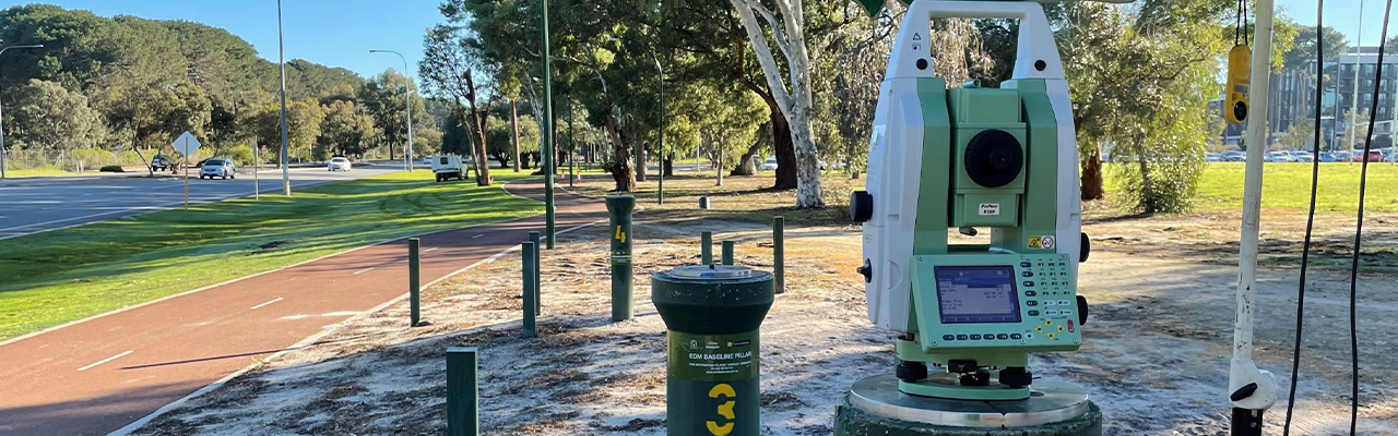
To enable EDMI calibration, Landgate provides three EDM baselines and software. An EDM baseline consists of several stable concrete pillars which have been accurately surveyed (and certified) to determine distances. The EDM baseline is surveyed at regular intervals or as required. Landgate is a NATA accredited organisation as a verifying authority of length on EDM baselines. Landgate surveys and issues a Regulation 13 (of the National Measurement Regulations 1999 (Cth)) certificate on the three Baselines every two years (or as required).
EDM baseline locations:
- Curtin University, Kent St, Bentley, 24 hours 7 days a week
- Kalgoorlie Explosives Reserve, Piccadilly St, 7am to 3pm, Mon-Fri. Booking required.
- Busselton Bypass 24 hours 7 days a week
Booking sheets:
Digital level barcoded staff calibration
Landgate provides a barcode staff calibration range facility located on the Land Surveyors Licensing Board's examination site at Boya (Darlington) which consists of two observing pillars and a series of 21 stainless steel pins set in a solid granite outcrop. The range is regularly monitored to ensure its accuracy and stability.
Landgate offers this self-service online staff calibration data processing service: https://staffcalibration.es.landgate.wa.gov.au/.
Note: the portal may take up to 30 seconds to load. This new service replaces the previous downloadable user processing “Staff” software application.
GNSS testing facility
Landgate provides a Global Navigation Satellite Systems (GNSS) testing facility located at Curtin University. The GNSS testing facility consists of 5 pillars that are regularly monitored (horizontally and vertically) to ensure highest accuracy and stability.
Landgate also provides this GNSS test network guideline to encourage a uniform approach to testing GNSS equipment.
The GNSS testing facility is available at Curtin University, Kent Street, Bentley, 24 hours, 7 days a week